


Briançon, France -The Col d'Izoard is used frequently by the Tour de France and the Giro d'Italia so with a spare morning available (thanks to the generosity of my wife!) I thought I would tackle this famous climb. At 19.5km in length at an average gradient of 6.5% (from the Briançon side) it is a decent, hard climb but it is not ranked as one of the most challenging in the Alps either.
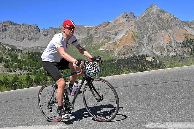
That said, I found it pretty hard. Indeed I found it the hardest of four climbs I did in the Alps this summer, even though on paper it should have been the easiest. In my defence, I'd had a bad night of sleep, not eaten enough breakfast and only arrived in Briançon - my start point - at about 11am, by which time it was already 27 degrees. Conditions do matter.
I started by parking in the first car park I came to in Briançon, which was a mistake as it was by the entrance to the walled part of the ancient city, which is actually quite a long way from where the climb to the Col d'Izoard starts. Another time I would drive down into the valley and park in a supermarket car park (which would have been closer and also free). I was glad I hadn't attempted to ride to Briançon from by base in Italy as the rode between Italy and France did not look like a pleasant cycling road - lots of cars and narrow lanes would have made for a potentially hairy ride (says someone who rides in London all the time) - but there were a few other cyclists getting there by the 'honest' method of travel.
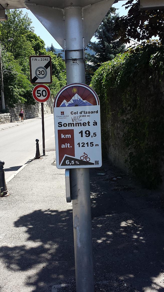
From the car park I rolled down a steep hill (all the while thinking I would have to go up it again on the way back) and reached the sign for the start of the climb. The initial 5km is fairly easy, out through the outskirts of the town and then alongside a river, with the climb never going above 5 degrees. There is then a short kilometre or so where the road kicks up a little before settling down at around 5 degrees up until the 10km mark. All the way there is a bike lane and markers every kilometre showing how far you have to go to the summit and also the steepness of the next section.
Around the village of Cervières, which is roughly about 10km in, a French cyclist caught me up and started chatting. "Here is where the climb really begins," he told me. And he was right. From there the climb does start in earnest, picking up to an average of about 8.5 degrees for the next 7 kilometres. The temperature by then was in the low 30s and that, combined with my lack of sleep, ensured that my pace was pretty pedestrain. Indeed, after about 16km of the ride I stopped for a rest, some water and a check of my emails. Only the pitying looks of a couple of cyclists coming past ensured that I was straight back on my bike two minutes later.
If I hadn't been feeling a bit rough I am sure I would have enjoyed the beautiful surroundings a bit more and also appreciated the relative lack of cars. By comparison with cycling the Stelvio Pass or the Galibier, it was relatively empty and the road conditions are also excellent, especially by comparison with some of the other Alpine passes.
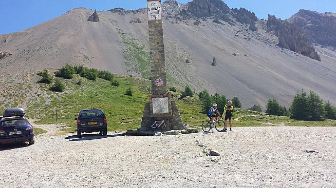
Fortunately for the last 2.5km the steepness of the climb drops down to about 6.5% and with the summit in site I felt much happier, powering past the photographer from Griffe Photos (who very efficiently had a little card with my rider number on to hand over as I cycled past and uploaded them to his website that evening) and hitting the summit feeling the best I had done all day. The summit has spectacular views down the valley to Guillestre and over the famous Casse Déserte and had I more energy I would have headed down the valley and then done the 16km ascent from the other side, which looked wonderful.
At the summit (2,360 metres) the surroundings look a little like a lunar landscape and it is very stark and exposed - in less good weather I could imagine it would be pretty bleak and could well be quite dangerous for cyclists. As it was, there were lots of cyclists and photographers. What I wish I had done (but didn't know about) was descend one kilometre down the south side to the small museum to Fausto Coppi and Louison Bobet, two great riders who had many battles on the Col d'Izoard in the 1950s.
From the summit I descended about 400 metres to the refuge Napoléon, a lovely little restaurant serving solid mountain food with a very comfortable sun terrace. A Coca Cola and a small beer later (and a 20 minute business call, alas) I set off on the descent back to Briançon, which was fast and extremely fun. With very few cars on the road and a relatively non-technical descent I was able to get up some really good speed, hitting over 70kp/h on several occassions, and this is a route I can thoroughly recommend.
The Col d'Izoard is rightly famed as one of the HC climbs of the Tour and next time I will be back to tackle it from the south side, hopefully after a decent feed and a full night of sleep.
0 Comments